Posts

Showing posts from September, 2022

Cave Clean Up Lahesh

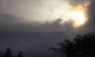
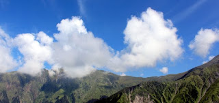
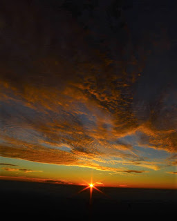
CAVE CLEAN UP LAHESH During our first Indrahar Pass trek we noticed badly trashed vicinity and Lahesh Cave so decided to come back and clean up some of bit. Though our First attempt to Clean Up Lahesh Cave was success but still there were plenty of bottles stuffed around and we had planned our 2nd Lahesh Cave Clean Up drive by the end of 2013 but were barred due to sudden change in weather followed by snowstorm and hence 2nd drive was postponed till 2014. July 15th 2014, we conceptualized our second high mountain clean up drive. On July 20th left for Lahesh Cave after our sponsored (sponsored by Manu in terms of Lunch and Mat) day halt in Triund Hill we continued for SnowLine Café and Lahesh Cave. Since thick fog was inbound so after 1 hour trek we crossed SnowLine Café without a pause and met few returning villagers who were in Laka it was 04:30 PM and we were getting doubtful of reaching Lahesh Cave as thick fog had covered whole of Laka and the trail. In Laka we stopped for a few mi

Holy Mountains

Holy Mountains Mostly people refer Mountains as nothing but a heap of granite boulder and rocks…may be, but these days, it is opposite! January, 1st, 2017, I completed my year’s first humanly solo hiking and hill-walk all the way to Billing and RajGundha, the gateway to Thamsar Pass, Bara Bhangal of high Dhauladhar Mountains! By 02:00 pm I was back at Bir and boarded Anurag Bus service for Baijnath, as the passengers boarded along the bus, a tourist couple/friends (may be from Delhi/Gurgaon, as they later boarded Delhi bound bus) also boarded on the way (my guess they had landed after paragliding from Billing). Then after some distance a local folk’s family boarded. One of its family members sat on the empty seat by my side. The bus was moving to Baijnath. My mind still in RajGundha, still repenting for not having stayed over there and ending my solo-hike at Barot, which of course was not planned! Anyway we approached Baijnath, the tourist couple/friend stood up to get off at the entry

DJANGO UNCHAINED

 DJANGO UNCHAINED DJANGO UNCHAINED IN BILLING I was looking for some easy winter snow hiking spot out side of my area. Then got the reference to a place of worship near Chinna Pass (motor-able road but now the road is blocked with slides and fallen trees, the reason they had cut out the road from hillsides and left the roots of the big trees exposed  and come monsoon those trees could not hold on and result in landslides). Chhinna Pass, I had done solo hiking somewhat close to RajaGhundha and even had crossed this so-called road mountain pass (Chinna Pass) but had not realized that I actually crossed a mountain pass until I read about Chinna Pass on the internet. Now it is more like a road crossing then a mountain pass but again a reminder that this road is now closed with multiple landslides. Billing is the highest take-off site for Paragliding in India and Asia, beside Tendem Flights, you can also enjoy Day hikes, multiple day hikes and camping. Even in Billing there is suitable allo

What To Do Around Dharamsala

Image
 What To Do Around Dharamsala There are numerous trek around Dharamsala, like Kareri Lake, Thatharna Trek and then Jalsu Trek. A MUST DO EASY TO MODERATE TREK BY ANY ADVENTURE ENTHUSIAST AND NATURE LOVER BEFORE THE SYSTEM CONVERTS IT IN TO HELL IN THE NAME OF DEVELOPMENT, EASY ACCESS, SAVING TIME, COMFORT AND WHAT EVER KIND OF EXCUSE WE HUMANS CAN COME UP WITH 

Dehnasar Lake

Image
 Dehnasar Lake of SHAKTI It is said that the form of SHAKTI Nature and the beloved of SHIVA, Mata Parvati comes to bath in Dehnasar Lake during Bhadon (भाद्रमास ) falling between August and September. Dehnasar Lake of SHAKTI I had thought at least this stretch up to the lake should be trash free, but it was not, for the civilized “pilgrims” throng here   The name of this lake has been mutilated in many forms like Danser Lake, Dancer Lake, Dainasar Lake, Danasur Lake! Situated at an approximate height of 4280 meters (14,040 ft) above MSL. Surrounded by high edgy cliffs of mighty Dhauladhar Mountains, this is one of the high mountain lakes just like Lam Dal, Nag Dal and others. 

Trail Run Over The Hollow Hills

Image
  TRAIL RUN OVER THE HOLLOW HILLS Trail Run  Hills and Mountains have fascinated my soul ever since myself was of around one feet of height! I always wanted to see what lies behind that hill or the mountain. But I didn’t knew, one day I’d have an epic trail run over the hollow hill. When ever I go hiking to the new hills or the mountains or even go the same hill or mountains. The curiosity always gets refreshed.

Free Tips For Monsoon Trekking

Image
 Free Tips For Monsoon Trekking Monsoon is one of the most beautiful season in North India and presents some of the best views in the Mountains. The hills become all green. Then there are the Gaddi shepherds grazing their flock of sheep and goat. Monsoon season usually starts from mid to the end of June and lasts till the first week of the September month. The views after rain are crystal clear with no smudge of pollution or smoke.The Sunrise happens to be clear and same with the Sunsets. But very recently, things have changed drastically due to the Climate Change and Global Warming. Nowadays Monsoon season is seen as a threat. Climate change has changed the pattern of rainfall in the monsoon season. There are news of the landslides every other day along with floods. Landslides are common but it has increased very recently. So trekking and hiking in the season of Monsoon is almost considered unsafe. There are parts and places where you can undertake day hikes and even long days trekkin

Billing Hiking Trekking and Camping

Image
Billing Hiking Trekking and Camping How to Go Hiking Trekking to Billing View of Water Tank to the right of Bir Billing Road Just to your left, you will notice a rough trail going northward, here is a map link for the Bir-Billing Jungle Trail. The Bir Billing Jungle Trail The trail for the temple of Mata Shatvadini Temple of Mata Shatvdini   The Bir Billing Jungle Trail The View of Forth Trail and Road Intersection from steep point of Bir Billing Jungle Trail Billing, the Second Best Paragliding Launch site of Asia in Kangra, Himachal Pradesh, India

Thatharna Trek Clean Up

Image
Thatharna Trek Clean Up After another high mountain trail tracing, we were able to embrace Dhauladhar Mountain. Along the way comes, Thatharna hill. Thatharna trek is another grazing point, used by the shepherds and local cattle herders. From an altitude of around 2,640 meters, Thatharna boasts 360-degree view of Dhauladhar Mountains and Kangra valley.   As usual, the sunset view from Thatharna trek is spell bounding. Thatharna calls for some effort and energy to climb up and reach there. Trek to Thatharna starts from Kharota village and goes uphill, a steep climb. The trek has the burnt of years of mining of slate. Some of the slate mines are illegal and some have valid license. From Kharota, the trail goes through few houses and then a temple to our right-hand side. Kharota village had few home-stay options but now we have hotels and campsites as well. You can reach Khadota via Dharamshala then Khanyara town. You can also reach Kharota via Sidhpur then Khanyara. There are two road

Mountains

Image
 Mountains Dhauladhar being mighty mountains from centuries are still humble and their beauty teaches the fellow trekkers and hikers to be modest and generous to each other and in day to day life. Yet most of the trekkers going over Triund and pass Dhauladhar are reluctant to learn being humble instead they behave opposite. 90% of trekkers don’t greet fellow trekkers while they pass along nor even smile they simply ignore the fellow trekkers and move on. Trekking is no fun if one doesn’t greet or smiles to fellow trekkers. Without any politeness the trekking to such beautiful, lively and humble mountains is just like Show off and full of ego. These mountains have been on this beautiful earth before humans and have seen generations of humans come and go.…humans will come and go but these mighty mountains will remain as they are till the end of the World…so we all should learn to be generous and humble to each other during trekking and in our regular lives.

Panchal Deva Mountains

Image
 Panchal Deva Mountains How was our Date with Death at Panchal Deva Mountains HOW OUR DATE WITH DEATH AT PANCHAL DEVA RANGE   They hire two senior guides for their exit trek from one of the remotest points. All of it started with one experienced trekker, two trekkers and businessmen. One energetic wanderer and one amateur trekker all from Himachal Pradesh. It was the beginning of our Date with Death. The two senior guides are Shri Durga Ram and Shri Maan Singh Gurung! First day of trekking starts with some easy to moderate walk through dense forest. With all black shades, Ravi River runs madly beside the trail. We did not knew this was the beginning of our Date with Death at Panchal Deva Range. The trail has constant and clearly visible huge footprints of chubby and furry wild friend. It reminded to us that we are venturing in the home of the Brown and the Black Bear!   The first days walk turned out easy and long. But it was refreshing with beautiful fragrance of the herbs all along t